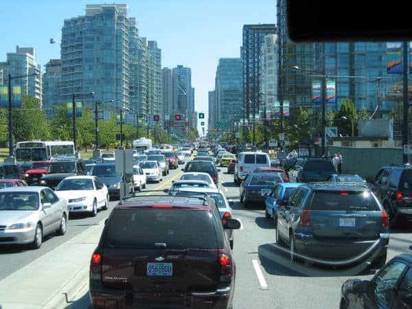
Researchers map CO2 emissions with mobile sensors on Vancouver cars

 UBC Researchers are mapping CO2 emissions with mobile sensors on Vancouver cars.
High tech has emerged as a major player in the movement to build healthier, carbon-friendly and more efficient cities. From green infrastructure and buildings, to street lighting and water quality sensors —even sensors to tell you when city garbage bins need to be emptied— the trend to develop smarter, more connected cities is today being fueled by innovations in nanotechnology.
Tiny, cheap and easy to deploy on a mass scale, sensors can give city planners much more information to tap into how their city is functioning and how to make it even better.
Now, researchers at the University of British Columbia have created a fleet of mobile sensors to measure CO2 emissions at street level, giving municipalities a new way to track the level of greenhouse gases in high detail.
“Being able to accurately know how much and where greenhouse gas emissions are emitted in cities is important for planning reduction strategies,” says Andreas Christen of UBC’s Department of Geography and Atmospheric Science Program and co-author of the new study in a press release. “From a planning and policy perspective, there is a need to have fine-grained and detailed information how much emissions come from a specific street, block or neighbourhood and how emissions change over time.”
The researchers developed small, lightweight sensors that combine an infrared gas analyzer with geo-reference technology and then attached them to cars which were driven around Vancouver to take in emissions data.
Not too surprisingly, they found that the highest emissions were recorded in the downtown area and on some of the arterial roads. What proved most interesting were the reductions in CO2 emissions in the greener, more leafy parts of town.
“We also found areas where carbon dioxide was absorbed, as in Stanley Park, and in some highly vegetated neighbourhoods,” says Joseph Lee, lead author of the study also from UBC’s Department of Geography and Atmospheric Science Program. “Here we expect trees and vegetation to absorb more carbon dioxide than humans locally emit.”
The researchers see their street level sensors as working in tandem with sensors deployed on towers, which can give readings higher up.
The combined information will be crucial to figuring out which kinds of emissions reduction efforts — from electric cars to green roofing to planting more trees — are making an impact.
“For example, if cities take steps to reduce emissions, like introducing more electric or hybrid vehicles to transit systems, it’s important to be able to monitor and measure how effective emission reduction efforts are at the local level,” says Christen. “Our mobile mapping technology could help to monitor emissions over time in high detail.”
The new research is published in the journal Atmospheric Measurement Techniques.
Recently, communications giant AT&T signed a deal with GE to deploy its Current CityIQ streetlight sensors in cities across the United States and Mexico.
The project aims to put outdoor LED lighting sensors to create a “digital infrastructure” that will track and help address issues like traffic flow, parking, air quality monitoring and even gunshot detection.
“Intelligent lighting plays a huge role in a smart city,” said Chris Penrose, president, Internet of Things Solutions, AT&T, in a statement. “Our collaboration with Current will enable us to use a city’s existing lighting infrastructure to more securely connect sensor-enabled networks.

