Intermap caps busy week with five sales
Intermap’s ambitious NEXTMap project has been costly, but the company is now winning business with greater regularity. Digital mapping company Intermap (TSX:IMP) today announced that five unnamed telecommunications companies have now become customers of the partnership between Intermap and Paris-based wireless player Mentum, which the pair signed last December.
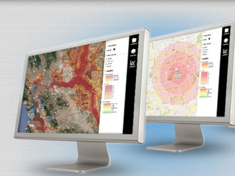
Wireless operators, says Intermap management, will use the company’s Cityscapes HD, which provides height-attributed land-use geodata for propagation modelling. The company says the mapping solutions are a better and more cost-effective solution to measure the height of vegetation and man-made structures.
“We’re pleased with the initial results of our strategic partnership with Mentum and our plans call for more joint sales efforts as we continue to focus on additional 3-D business intelligence opportunities,” said Todd Oseth, Intermap’s President and CEO, Intermap. “If you’re a wireless network operator,” he added: “this partnership and the Cityscapes HD product [offer] the missing ingredient that you need to optimize your network: true clutter-height data instantly available across large distances. In addition to our first five customers, we are anticipating there will be other wireless telecommunication companies that will purchase this valuable Cityscapes HD product in the future.”
__________________________________________
This story is brought to you by Cantech Letter sponsor BIOX (TSX:BX). The largest producer of biodiesel in Canada, BIOX’s proprietary production process has the capability to use a variety of feedstock, including recycled vegetable oils, agricultural seed oils, yellow greases and tallow. For more information CLICK HERE.
____________________________________________
Mentum serves more than 375 wireless clients, including large operators such as Sprint, TELUS, and Clearwire.
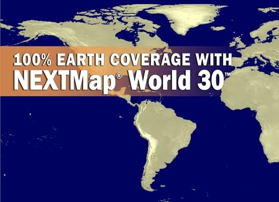
Intermap, which was founded in 1996 and is now based in Colorado, began its corporate life by designing 3D digital elevation maps. In 2002, however, the company embarked upon an ambitious project called NEXTMap, with the goal of providing 3D terrain data for the entire surface of the world. The NEXTMap data library already contains millions of square kilometres of high-resolution elevation data, and provides realistic displays of topographic information including vegetation and cultural features such as buildings and roads. The project, however, has been costly. Intermap lost (US) $13.6-million, or $.19 cents per share in 2011, after a whopping loss of $97.8-million (U.S.), or $1.73 per share in fiscal 2010.
Today’s announcement comes on the heels of two recent wins. On Wednesday, Intermap was awarded a (US) $517,000 task order from Virginia-based architecture and engineering firm Dewberry & Davis for the second phase expansion of its previously announced airborne radar mapping services project in Alaska. And yesterday, the company revealed it had received a $260,000 contract to provide digital elevation data from its NEXTMap database to another unnamed client in North America.
At press time, shares of Intermap were up 16.7% to $.175 cents.
_________________________________
__________________________________
Nick Waddell
Founder of Cantech Letter
Cantech Letter founder and editor Nick Waddell has lived in five Canadian provinces and is proud of his country's often overlooked contributions to the world of science and technology. Waddell takes a regular shift on the Canadian media circuit, making appearances on CTV, CBC and BNN, and contributing to publications such as Canadian Business and Business Insider.
Related Posts
Beacon Securities analyst Russell Stanley maintained his “Buy” rating and C$3.00 target on Intermap Technologies (Intermap Technologies Stock Quote, Chart,...
Beacon Securities analyst Russell Stanley maintained a “Buy” rating on Intermap Technologies (Intermap Technologies Stock Quote, Chart, News, Analysts, Financials...