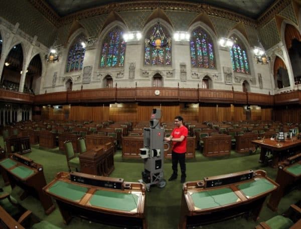

After conquering the mysterious depths of the ocean, the mysterious inner reachings of Canada’s Parliament are next.
Google Street View is today mapping the floor of the House of Commons, the Red Chamber of the Senate, the Library of Parliament and the Prime Minister’s Office.
And no, it’s not the iconic Google Car navigating the tight turns of the House of Commons hallways, but the The Google Maps Trolley, a push-cart that was originally designed to fit through museum doorways and navigate around sculptures in Europe. The trolley is equipped with a panoramic camera to collect 360-degree views, motion sensors to track Trolley’s position, a hard drive to store data, and an onboard computer to operate the system.
Google released Street View on On May 25, 2007, providing panoramic street-level views of five U.S. cities. The service has since expanded to thousands of locations around the world. Google has since added aerial views of certain cities, as well as an underwater view of six coral reefs, including Australia’s Great Barrier Reef and Hawaii’s Hanauma Bay.
Google says it Street View will soon allow users visit the interiors of Canadian landmarks such as B.C. Place and the Calgary Saddledome, historical parts of Quebec City and Toronto’s Royal Ontario Museum.
Leave a Reply
You must be logged in to post a comment.


 Share
Share Tweet
Tweet Share
Share


Comment