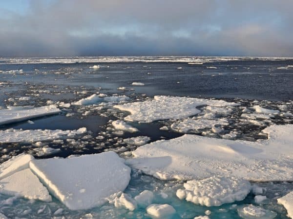
 Partly for the potential of its fabled shipping route, the Arctic is becoming a hotly political place these days. But a new study says that despite intense and widespread concerns about global warming, the ice in the Northwest Passage is still too thick for commercial shipping traffic to navigate safely.
Scientists at York University conducted the first ever airborne electromagnetic ice thickness surveys over the Northwest Passage for a research paper called paper, “Ice Thickness in the Northwest Passage”, which was published in the journal Geophysical Research Letters. The surveys were conducted between 2011 and 2015 and showed a mean thickness of more than three metres and noted that thick ice features that are more than 100 metres wide and four metres thick were common.
“This is the first-ever such survey in the Northwest Passage, and we were surprised to find this much thick ice in the region in late winter, despite the fact that there is more and more open water in recent years during late summer,” said lead researcher York Professor Christian Haas, who is also the Canada Research Chair for Arctic Sea Ice Geophysics. “This points to the importance of ice transport from the high Arctic and melt processes during the spring season, which critically depend on weather conditions and how they affect the melting of thick ice.”
In August, the Russian government announced it would claim 460,000 square miles of Arctic territory, asserting that it had delivered “ample scientific data” to the United Nations to support its claim.
The study says the decline of Artic sea ice and longer melt seasons in the Canadian Arctic Archipelago have led some to develop future climate models that suggest the Northwest Passage could be navigable by mid-century. But it warns that this data should be regarded with caution because the coarse resolution used likely had difficulty capturing intricate sea ice dynamic processes within the narrow channels of the Canadian Arctic Archipelago.
The Northwest Passage is a sea route connecting the northern Pacific Oceans through the Arctic Ocean, winding through the northern coast of North America through the Canadian Arctic Archipelago. The Canadian government regards the Northwestern Passages part of Canadian Internal Waters, but others view it as in international strait and transit passage. In 1969, an oil tanker named the SS Manhattan was first commercial ship to cross the Northwest Passage. It sparked a debate about country’s sovereignty in the Arctic throughout the Trudeau administration, a debate that has been rekindled in this decade.
In August, the Russian government announced it would claim 460,000 square miles of Arctic territory, asserting that it had delivered “ample scientific data” to the United Nations to support its claim. The actions followed on the symbolic exercise of 2007, when a submarine planted a titanium-encased Russian flag on the sea floor near the North Pole. Russia claims an underwater mountain range that stretches across the Artic sea known as the Lomonosov Ridge is part of its own landmass.
A recent US Geological Survey estimated that 30% of the world’s undiscovered gas and 13% of undiscovered oil lies within the Arctic circle. There’s also huge quantities of of minerals, including copper, nickel, phosphate, bauxite, and iron ore.
Russia, of course, isn’t in the Arctic for no reason. A recent US Geological Survey estimated that 30% of the world’s undiscovered gas and 13% of undiscovered oil lies within the Arctic circle. There’s also huge quantities of of minerals, including copper, nickel, phosphate, bauxite, and iron ore.
Russia, Canada, the United States, Norway and Denmark are the five states who currently have Polar claims, and the tensions in the area are increasing. In March, the Russian military conducted Arctic drills involving dozens of ships and submarines, 38,000 troops and 110 aircraft.
Canadian Prime Minister Stephen Harper, meanwhile, said he was concerned about the increasing militarization of the Arctic.
“I just think we should not be complacent, because we have seen over the period that President Putin has been in power just a gradual growing in aggressiveness of his government toward neighbours and the gradual military assertiveness of that country, and I just think it’s something we should never be too at ease about,” he said.
Environmentalists are trying to bring a still larger context to the debate.
“The melting of the Arctic ice is uncovering a new and vulnerable sea, but countries like Russia and Norway want to turn it into the next Saudi Arabia,” says Greenpeace Russia Arctic campaigner Vladimir Chuprov. “Unless we act together, this region could be dotted with oil wells and fishing fleets within our lifetimes.”
Comment
Leave a Reply
You must be logged in to post a comment.


 Share
Share Tweet
Tweet Share
Share


This is how it works. Melting ice goes into the ocean raising the freezing point. So it freezes more.
What a bunch of hog wash rhetoric – If you go looking for thick ice you can find ice… if you go looking for a Northwest Passage navigation route you have seven (7) to select from… this 2015 ALL ROUTES WERE OPEN. This article is extremely disappointing to see publish. Do a tiny bit of homework instead of regurgitating the media’s garbage… Please consider the following “major” voyages through the Northwest Passage – in 2014 NUNAVIK carried 23,000 tons of ore, in 2013 NORDIC ORION carried 73,000 tons of coal and in 2012 the 43,524 GT private cruise ship THE WORLD transit the Northwest Passage. There are many others… check the records. There have been more than thirty “small craft” (yachts) transit the NW Passage in the last three years. THAT THICK ICE DIDN’T STOP THOSE TINY FIBERGLASS YACHTS. I WONDER WHY? Here are the NWP records: http://www.rccpf.org.uk/images… Geeze!
So long as the Russians stay on their side of the North Pole .. they know it too, that’s why they stuck their flag there.
Note the facts, ignore the politics. Some ice is +100m wide and +4m thick, making routine navigation by light craft unsafe. Many large ships can handle 4m thick ice, especially the Norwegian-built ice-breaker bulk carriers designed for the Norilsk Siberian Artic run. Arctic waters were more ice-free in the 1930s when Canadian maritime authorities patrolled the then wide-open North West Passage routes.
Antarctica has had its largest freeze-up on record but hopefully for the baleen whales, this huge mass of sea ice should melt significantly the polar cycles move into their next phase. The heavy sea ice in Antarctica has reduced whale access to krill which has had many flow-on affects in the southern oceans, including shark and orca patterns.
Nobody truly knows why these polar cycles happen. Ask yourself why so much research is said to be needed – to learn about a huge, multi-disciplinary global phenomenon.
Here’s a conundrum to ponder: why has the recent magnetic maps by Europe’s SWARM project showed a positive magnetic feature in Antarctic areas where ice is building-up and magnetic lows where ice is decreasing (near Sth America)? Mankind has a lot to answer for but not for global magnetics, surely (but maybe humans did this too – too many compasses in Antarctic expeditions?). TIP: polar magnetics play a crucial role in shielding earth from BOTH the solar wind radiation and the massively powerful cosmic rays which we do not understand enough about yet. The interplay between these two sets of subatomic particles and nuclear debris could outweigh all other factors in climate. But the true answer is – we simply do not know.