

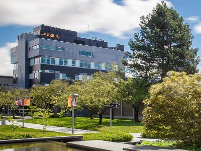
At a time when employers in the tech sector are worried about the lack of talent to fill specific jobs, Langara College in Vancouver is launching a new Geographic Information Systems (GIS) program, set to begin in January.
The geomatics sector analyzes and delivers geospatial information for all kinds of purposes: transportation, construction, utilities, natural resource management, weather analysis, property boundaries, emergency response services, etc.
For retail purposes, geomatics can make more precise the spatial relationships between social networking, leisure, tourism and shopping.
“I am excited to launch the Geographic Information Systems (GIS) Certificate Program, a wholly new program area for Langara Continuing Studies. GIS is an important field of study that is bringing new precision to a wide range of professions, including cartography, urban, and rural planning,” said Langara Continuing Studies Dean Dan Thorpe.
A recent study for Natural Resources Canada showed that about 2,450 private sector geomatics firms contributed $2.3 billion to the Canadian economy in 2013.
The use of geospatial information contributed $20.7 billion, or 1.1% of GDP, generating about 19,000 jobs to the Canadian economy in 2013.
The Langara program will be the first of its kind in Canada in the sense that it will be taught using entirely low-cost open source software, namely QGIS, GRASS and Inkscape, on each student’s own laptop computer.
This is in contrast to education using other proprietary GIS tools, which are sold using an expensive per-seat licensing model.
“We are excited to be at the forefront of a whole new wave of GIS, thanks to high-quality, open source software. This free software eliminates the barriers that commercial GIS software had imposed,” said instructor Jim O’Leary. “There is no limit to what we can do with GIS when the tools are freely available.”
The aim of the program is to provide students with a grasp of fundamental concepts of GIS and hands-on experience, with an emphasis on creating low-cost, professional quality results.
The use of “open” geospatial data, according to Natural Resources Canada, provided an estimated additional $695 million to GDP and accounted for $635 million in real income in 2013.
“GIS used to be a complicated and specialized tool, used only by a narrow range of professionals,” added Thorpe. “Our certificate will bring the use of GIS software and techniques to a much wider audience. Two unique qualities enable this: a part-time format accessible to working students, and the use of affordable and accessible open source software.”
Langara will offer each 18-hour course over six three-hour sessions on evenings and weekends.
About The Author /
Leave a Reply
You must be logged in to post a comment.


 Share
Share Tweet
Tweet Share
ShareTRENDING
All Trending →
TTNM keeps “Buy” rating at Haywood
March 20, 2024

NEO stock has price target chopped at Paradigm
March 18, 2024
Groupon’s turnaround is accelerating, Roth says
March 18, 2024
Comment